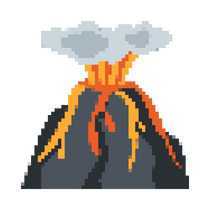
Eruption of Mt. Taal
This website contains information on the eruption of the Taal volcano.


Nature of Disaster
Disaster Mitigation
Vulnerablity & Exposure
Quiz!
Find Reference
1. Nature of Disaster & Date and location of the disaster where it caused damages.
There are two nature of disasters, natural and man-made disasters. Last January 12, 2020, a volcano called Taal Volcano erupted. It is located in the province of Batangas. The Taal Volcano eruption is classified as a natural disaster.
Hazard
It was classified as a geologic hazard before being a disaster that made an impact on the lives of many people, plants, animals and infrastructures. A geologic hazard is a natural phenomenon occurring in the earth's crust that poses a danger to life and property.
2. Disaster mitigation techniques done prior to, during after the disaster.
The eruption took place on January 12, 2020.
Mitigration techniques done prior to Eruption
Strategic initiatives for years 2017-2020 (Volcanic Monitoring, Eruption, Prediction, Volcanic Hazard assessment)
| National volcano Monitoring and Warning |
| Volcano Hazard assessment and research and Development (VHARD) |
| Volcano, Earthquake and Tsunami Disaster preparedness and risk reduction |
Mitigation techniques done after disaster
| Community engagement and accountability (CEA) |
| Green Response |
Mitigration techniques done during eruption
The Philippine Red Cross collaborated with (i) NDRRMC; (ii) provincial, municipal, and barangay (village) disaster risk reduction and management councils; and (iii) local government units for an Emergency Plan of Action (EPA)
| Relocation/ Evacuation |
| Advisories |
| Response Activities |
| Displacement |
| Livelihood & Basic Needs |
| Water, Sanitation & Hygiene |
| Protection, Gender and Inclusion (PGI) |
| Health |
Click texts to see details
3. Vulnerability and exposure level of the community that can be identified based on the damage report.
The Taal Volcano is located on Volcano Island and is classified as a Permanent Danger Zone; nonetheless, roughly 53,697 people (10,131 families) and CHF 129 million in infrastructure are located within a 10-kilometer radius, and 2.81 million people are located within a 30-kilometer radius (AHA Centre). Taal Volcano is one of the Philippines' most active volcanoes, with over 30 eruptions recorded. The last time Taal Volcano erupted was in early January 2020, affecting over 736,000 people in CALABARZON (Region IV-A), Central Luzon (Region III), and the National Capital Region (NCR), and resulting in the evacuation of more than 135,000 people, as well as damage to infrastructure and livelihoods, and disruption of essential services such as water supply and education. Sulfur dioxide emissions peaked at 14,326 tons per day on June 28, 2021, and volcanic smog was observed across CALABARZON, the National Capital Region, and other portions of Luzon. The eyes, throat, and respiratory tract can all be irritated by volcanic haze. People with pre-existing medical issues, the elderly, pregnant women, and children are particularly vulnerable. Taal Volcano is located within Taal Lake, a volcanic tsunami is also a possibility. Due to the potential threats of pyroclastic density currents and volcanic activity tsunami, PHIVOLCS has strongly urged that the Taal Volcano Island and high-risk barangays of Agoncillo and Laurel, Batangas, be evacuated.
Location

Danger Zones
